
Follow a Rochester Hills Street Trail
A Rochester Hills street directory works best as a sequence, not a roster. The city and county systems attach different meanings to the same address. An assessor card can identify the taxable parcel and may show an owner or mailing label. The map can place that parcel among its lot lines. A land instrument can establish a recorded transfer. Historical sources can add a dated association with a street. Keep those roles apart. A map pin, grantee address, and parcel owner each answer a different question, and none alone establishes current occupancy.
- Normalize the address with the city geocoder or USPS tool, and record whether the match is exact, approximate, or out of range.
- Search Rochester Hills BS&A and Oakland County Property Gateway. Save the situs label, parcel PIN or Sidwell reference, subdivision or lot details, and search date.
- Use the parcel identifier in the Oakland County Register of Deeds path. Compare legal description, document type, recording date, and the parties before treating transfers as one chain.
- Check the city Building Department route for a defined permit or inspection question. A permit can document regulated work, but it does not establish continuous occupancy.
- For an older address, test Avon Township terms, section maps, newspapers, and library finding aids before deciding that a road or number did not exist.
Michigan.gov/Vote is an individual status and polling-information route, not a street list. Broader Qualified Voter File access follows a defined MDOS request process with statutory redactions. Use the least sensitive record that answers a real civic, property, or historical question.
Note: A parcel PIN or Sidwell number is the most reliable bridge among map, assessment, and deed systems.
Normalize Rochester Hills Street Addresses
Address spelling should be settled before a street search begins. The Rochester Hills Atlas geocoder accepts an address and exposes controls for category, country, match status, language, location type, search extent, spatial reference, and output format. A returned point may represent a rooftop, parcel centroid, street segment, or approximate location. USPS serves a different role: its lookup standardizes a delivery address with street, apartment or suite, city, state, and ZIP inputs. Neither system establishes a person at the address.
The Rochester Hills Atlas map index shows the official map choices available for street, ZIP, construction, polling, and related geographic work.
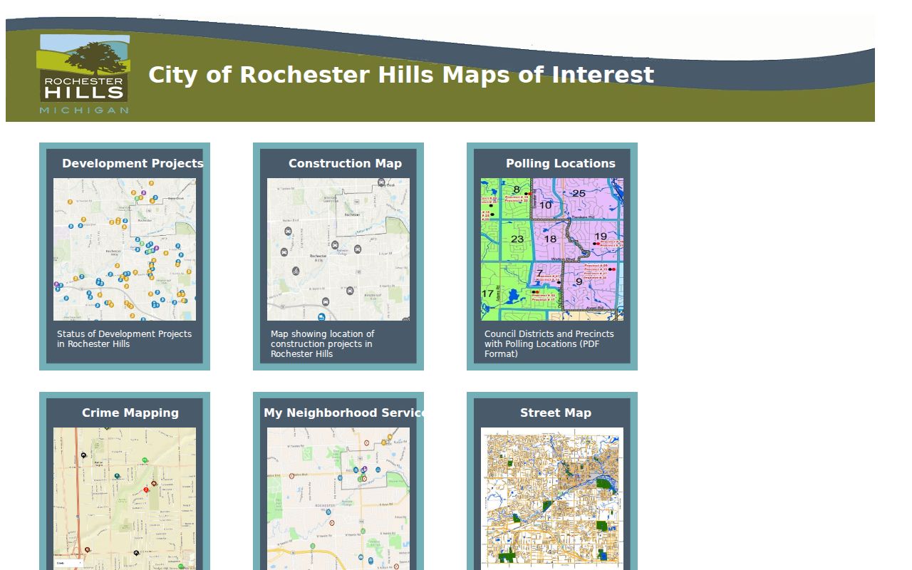
The index is a useful orientation layer before checking a dated parcel or deed record. It is not a legal boundary decision or a household list.
For old sources, preserve the original street form beside the modern standardized form. Research found no official complete Rochester Hills street-renaming or address-conversion table. A changed label needs an issuing map, ordinance, postal notice, or parcel and legal-description match before it is treated as the same location.
Rochester Hills Street Search Fields
The Rochester Hills BS&A assessor search names address, owner or name, and parcel number as possible starting keys. The FAQ does not publish the portal's exact wildcard rules or every required-field condition, so a search result should be read as the current service presents it. Sale search uses separate optional dates, prices, and property-class choices. Account-registration fields belong to the service account, not to the parcel record.
| BS&A search key | Field form | Known requirement | Use on a street search |
|---|---|---|---|
| Address | Text | One possible search key | Starts a current situs search. |
| Owner or name | Text | Used only when chosen | Finds a parcel association, not residence proof. |
| Parcel or PIN | Text | One possible search key | Connects city data to county GIS and deeds. |
| Sale date and price | Date and number | Optional filters | Reviews sales history and assessment context. |
| Property class | Checkbox | Optional filter | Uses the class options published by BS&A. |
The Rochester Hills BS&A assessor screen is the city-facing starting point for the address, name, and parcel search keys.
Read the labels and returned record date before carrying a parcel identifier into a map or deed search.
The Oakland County Property Gateway offers a second route. It accepts at least five characters of a PIN or address, supports partial text and a percent wildcard, allows comma-separated PINs, and permits map clicks. Its reports, aerials, and custom mapping can have separate fees.
Map Rochester Hills Streets by Parcel
Property Gateway is the right place to test the geometry behind a street result. Open the subject parcel, note the visible PIN and map extent, then inspect nearby boundaries without calling them a people list. County mapping can also point to reports, current or historical aerials, FEMA and contour products, and custom maps. Some of those products are paid. The property interface is a geographic and parcel tool, not a public directory of persons.
For a subdivision question, obtain the plat record, then compare the lot, block, subdivision, and legal description with the parcel. The county instructions route plat work through a PLAT Records search by subdivision and county, followed by the record and attachment images. A plat explains geometry. It does not supply a current owner or establish that a household is present.
Note: Save the map scale and source timestamp whenever parcel edges or adjacent parcels matter to the conclusion.
Rochester Hills Street Records Compared
Different address-keyed sources can be combined, but their scope must stay visible. This Rochester Hills address-records table places the search anchor, the historical boundary, and the practical check side by side. It avoids treating a delivery label, owner field, map point, or permit applicant as a universal resident entry.
| Address record layer | Search anchor | Reach or boundary | Best validation use |
|---|---|---|---|
| USPS lookup | Street, unit, city, state, ZIP | Current delivery standardization | Normalize the address before parcel work. |
| City Atlas geocoder | Address and match controls | Current geocoder, historical range unstated | Record exact, approximate, or out-of-range position. |
| BS&A assessment | Address, name, parcel | Current municipal parcel service | Compare situs, tax, assessment, and mailing labels. |
| Property Gateway | PIN, address, map click | Current parcel and GIS service | Inspect geometry and locate related parcel identifiers. |
| Permit and inspection route | Address or parcel | Record-specific, historic range unstated | Check regulated work and inspection status. |
| ROD land index | Name, PIN, document, legal description | Online material described from 1964 | Validate transfers and legal-description chain. |
| Historic maps and newspapers | Street, section, lot, date | Collection-specific coverage | Reconcile older roads and address context. |
A current address can also be checked with city Assessing, Building, Treasury, or Clerk staff by phone, email, or at the counter when the question belongs to that office. Michigan FOIA is a route for a narrow municipal administrative record, not a way to request an all-address roster.
Read Rochester Hills Address Roles
One address may occur in several records with different meanings. A situs address is the parcel's physical location for the assessment record. A mailing address is where tax correspondence is sent. A recorded owner is the person or entity attached to a parcel or land instrument. A party address in another type of record can be historical or supplied for contact. Keep the source and date with the label rather than turning each one into a claim about who is present today.
- Parcel
- A defined unit of land in the assessment or GIS system, commonly joined to related records by a PIN or Sidwell reference.
- Situs address
- The physical parcel location used for the assessor's record. It can differ from the address used for tax mail.
- Plat
- A recorded subdivision map that identifies lots, blocks, and layout. It supplies land geometry, not a person roster.
- Criss-cross directory
- An address-ordered historical directory format. No verified Rochester Hills run was located in the research.
The owner, taxpayer, mailing, and situs labels should be copied exactly if they appear. A parcel split, combined lot, retired PIN, or changed road name can create a valid mismatch that must be resolved through the legal description.
Trace Rochester Hills Street Deeds
The Oakland County Clerk/Register of Deeds is the land-record custodian. Its Super Index offers free searching of indexed material, while document details, downloads, or copies can have payment conditions. Work from the parcel PIN or legal description when possible. After a hit, compare grantor, grantee, instrument type, recording date, reception or document number, liber or page, and legal description. A matching surname by itself is only a candidate.
For a lot, condominium unit, plat, or metes-and-bounds chain, the Tract Index is the more specific county route. The computerized database begins in January 1964. Earlier material belongs to the office, microfilm, or records-retention process, even though county land records reach much farther back. Grantor/Grantee staff searches are available in person or by mail for $5 per name. The Register's office is also the place to ask for copies or help with a clearly identified legal description.
Note: When a deed's legal description breaks the parcel match, stop the chain and ask the tract or recording custodian before selecting a nearby parcel.
Rochester Hills Street Permit Clues
The city Building Department links permit applications, Building Permit Reports, inspection and property lookup, and BS&A services. A specific permit can help date regulated work at an address. Its usable fields may include the project address, type, issue date, inspection or final status, and applicant data, but the complete live field list was not captured in the research. For dated work, preserve the permit number and the code edition that applied instead of assuming the current rules governed the work.
The Rochester Hills Building Department provides the city route for permits, inspections, ordinances, and property-lookup services.
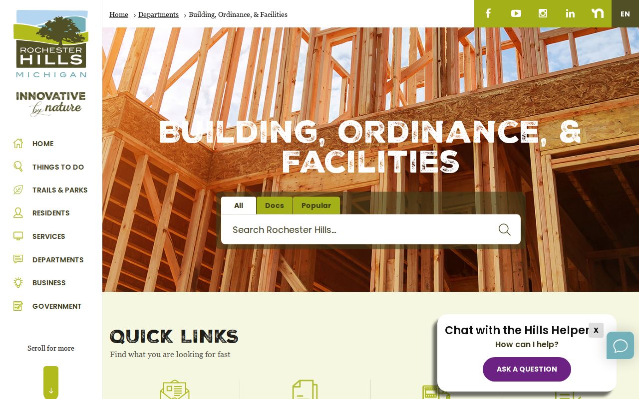
The department page makes it clear that a street investigation may need both online records and a request to the city department that keeps the defined file.
Avon Township Streets in Rochester Hills
Old street research needs the local boundary story. Rochester Hills developed from Avon Township, which was organized in 1835; the community became a charter township in 1978 and a city in 1984. A nineteenth-century assessment, deed, or map can therefore use Avon Township, Rochester, Rochester Township, township and range, or section language instead of Rochester Hills. That is a search-term difference, not evidence that the modern city did not cover the area.
Rochester Hills Museum Sidwell pages and RHPL's Sanborn and USGS map leads help reconcile sections, roads, lots, and historic structures. The construction-date map also warns that a gray road on a current map can postdate a historic building. Carry the old label forward as a research note, then confirm it against a parcel or deed rather than attaching a modern street identity by guesswork.
Rochester Hills Street Privacy Limits
The Rochester Hills street directory can document parcel and record relationships. It cannot supply a complete, verified list of everyone connected to a street. Michigan.gov/Vote is limited to individual status and polling information. Qualified Voter File requests have protected fields. The Michigan Address Confidentiality Program protects eligible participants and substitute addresses are not subject to FOIA. Driver and vehicle information also follows separate access rules. Sensitive identifiers, phone numbers, email, full birth dates, signatures, and protected addresses should not be collected or republished.
Lawful use. Use Rochester Hills address records for a defined personal, civic, property, or historical purpose. Michigan law prohibits stalking and harassment, and a public record is never permission to monitor, confront, or contact someone.
The distinction protects the record as well as the reader. An address appearing in a deed, permit, or historical paper can be outdated, a mailing contact, or simply an address role that is unrelated to present-day occupancy.
Rochester Hills Street Research Gaps
Several useful tools are not verified as complete local datasets. No official Rochester Hills reverse or criss-cross directory run was located. No exact city street-renaming list, city annexation chronology, or definitive ZIP-boundary polygon was found in the reviewed sources. The City Atlas says its ZIP map shows three codes that cover the city, while other official postal material identifies Rochester Hills service in the 48306 through 48309 range. Postal delivery geography and municipal parcel geography need separate checks.
When a portal does not resolve the question, use the documented fallback chain: city Assessing, Building, Clerk, or FOIA channels for a narrow city record; Property Gateway and the Register counter, mail, phone, or email for county parcel and deed work; then RHPL, the Rochester Hills Museum, OCGS, the Library of Michigan, or Archives of Michigan for older maps, newspapers, and finding aids. An incomplete result should remain a gap, not a filled-in narrative.
Note: Older land research often moves from the online index to office, microfilm, and archival sources after the 1964 boundary.